You arrive at an Alberta reservoir in May.
The water is high.
A shallow point extends into the lake.
There are pike beside the weeds.
Walleye are using the rocks.
You save the spot.
Then you come back later.
The shoreline looks completely different.
The point is exposed.
The weeds are somewhere else.
The water is several feet farther from where you parked.
You cast the exact same lure into the exact same area.
Nothing.
This is one of the biggest lessons anglers eventually learn in southern Alberta.
A reservoir is not simply a lake with a dam at one end.
Many Alberta reservoirs are working pieces of water infrastructure.
They store spring runoff.
They feed irrigation systems.
They supply communities.
They move water through canals.
Their levels can rise and fall as that water is stored and used.
And all of that can affect where fish live.
Alberta has the largest irrigated area in Canada, and more than 97 percent of it is within the South Saskatchewan River basin. The province says irrigation infrastructure includes more than 55 reservoirs and thousands of kilometres of canals and pipelines.
If you fish around Calgary, Lethbridge, Brooks, Medicine Hat or much of southern Alberta, learning reservoirs is one of the most useful fishing skills you can develop.
Because places such as McGregor, Newell, Crawling Valley, Little Bow, Forty Mile Coulee and many other southern waters do not always behave like a natural lake.
Southern Alberta Is Reservoir Country
Look at a map of central or northern Alberta and you find natural lakes everywhere.
Southern Alberta is different.
Natural lakes are much less common across large portions of the prairie.
Reservoirs have filled that gap.
An Alberta Conservation Association study of southern Alberta fisheries described natural water bodies as relatively scarce in the south and noted that many of the region’s major fisheries are man made irrigation reservoirs. The study examined Crawling Valley, Fincastle, Forty Mile Coulee, Keho, McGregor, Newell, Little Bow, Milk River Ridge and Rattlesnake Reservoir.
Those reservoirs now support serious recreational fisheries.
Walleye.
Northern pike.
Yellow perch.
Lake whitefish.
Burbot.
And in some systems, stocked trout and other species.
But the water was not created primarily for fish.
That matters.
A Reservoir Has a Job
A natural lake exists because of geology and hydrology.
A reservoir exists because water was intentionally stored.
Alberta explains that reservoirs are used for purposes including irrigation, municipal water supply, flood control, hydropower, recreation and fishing. Most major river reservoirs store high spring flows so water remains available later when conditions are drier and demand increases.
That means the lake level you see during one fishing trip may not be the level you see later.
Water moves in.
Water moves out.
Irrigation demand changes.
Snowmelt changes.
Rain changes.
Drought changes.
Reservoir operations change.
For anglers, shoreline structure can literally move.
Water Level Is Part of the Fishing Report
Most anglers check:
Weather.
Wind.
Temperature.
Maybe recent stocking.
On a southern Alberta reservoir, I also want to know what the water level is doing.
Alberta monitors reservoir storage and updates major reservoir storage information regularly. The province also operates monitoring on dozens of lakes and reservoirs and tracks water levels through its water monitoring network.
That information matters because falling water can change the lake much faster than many anglers realize.
A bay that was excellent earlier might become extremely shallow.
A rocky point can become exposed.
A weed line can shift.
A boat launch can become more difficult.
Fish may move away from shoreline habitat that previously held them.
You are not necessarily fishing badly.
You may be fishing yesterday’s lake.
Spring Can Look Completely Different From Late Summer
Alberta’s water supply follows a strong seasonal pattern.
Snowmelt and precipitation generally create higher flows during spring and early summer.
Reservoirs capture some of that water.
Later, during the warmer and drier part of the year, stored water becomes increasingly important for agriculture and other uses.
From an angler’s perspective, that creates a moving target.
Imagine a shallow bay during spring.
There is flooded grass.
New vegetation.
Warm water.
Small fish.
Pike.
It looks perfect.
Several months later, lower water may leave that grass completely dry.
The pike did not necessarily vanish from the reservoir.
The habitat vanished from the pike.
Now you need to find the replacement.
Falling Water Pushes Fish Somewhere
Fish respond when usable habitat changes.
They do not remain stranded beside the waypoint you saved in June because your phone says it is a good spot.
As water recedes, I start looking toward:
The first meaningful depth change.
The outside edge of remaining vegetation.
Old channels.
Points extending toward deeper water.
Steeper shorelines.
Rock.
Remaining cover.
Areas where baitfish have concentrated.
The exact answer depends on the reservoir.
But I stop thinking about the old shoreline.
I start thinking about the new one.
A Point Can Become Two Completely Different Spots
This is one reason reservoirs are interesting.
Imagine a point that extends underwater during high water.
At one level, the top sits in eight feet.
Perfect.
At a much lower level, the same top might be nearly exposed.
The fish that once sat on top could now be along the outer edge.
The location did not become useless.
The productive part moved.
This is where understanding contours becomes more valuable than memorizing coordinates.
You want to know the shape of the bottom.
Not simply where you caught a fish.
Old River Channels Can Be Extremely Important
Many reservoirs were created by flooding valleys, coulees or river corridors.
The original shape remains underwater.
An old channel can provide deeper water running through otherwise shallow reservoir habitat.
Fish can use those channels as travel routes.
The edge of the channel can create a natural break.
When water levels decline, these deeper pathways may become even more important.
If you have bathymetry available, look for them.
A subtle underwater channel can be much more useful than a random section of open water.
Reservoir Maps Become More Valuable When Water Levels Move
A contour map represents bottom elevation.
Your sonar shows current depth.
Water level determines how much water sits above that structure.
Put those pieces together and reservoir fishing becomes much easier.
Suppose a map shows a long underwater point.
At high water, the top might be relatively deep.
At low water, it may become a shallow feeding flat.
Same structure.
Different fishing opportunity.
That is why reservoir anglers should think in elevations and contours rather than fixed depths alone.
Irrigation Can Affect Fish Habitat Directly
Water level changes are not simply inconvenient for anglers.
They can affect fish reproduction.
A provincial assessment of Little Bow Reservoir specifically identified variable water levels associated with irrigation as a factor that can limit suitable spawning habitat for walleye and northern pike. The assessment noted that changing levels may contribute to unstable recruitment.
This makes intuitive sense.
Pike often depend on shallow vegetated habitat for spawning.
If suitable shallow habitat changes dramatically, reproductive success can vary.
Walleye also need suitable spawning conditions.
Reservoir operations can therefore influence the fishery long after the water level itself changes.
This Helps Explain Why Reservoir Fish Populations Can Be Complicated
Anglers sometimes look at a reservoir and assume:
There is lots of water.
Therefore there should be lots of fish.
Fish populations do not work that simply.
A reservoir can have excellent adult habitat while producing inconsistent young fish.
It can contain large old pike but fewer smaller fish.
It can have walleye that grow well but do not reproduce consistently every year.
Water levels are one part of that story.
Food supply matters.
Spawning habitat matters.
Predation matters.
Fishing pressure matters.
Stocking history can matter.
The reservoir you see above the surface tells only part of the story.
Many Southern Alberta Walleye Fisheries Were Built Through Stocking
Southern Alberta’s reservoir walleye fisheries are particularly interesting.
Alberta Conservation Association research notes that most of the major southern irrigation reservoirs were stocked with walleye to create recreational fisheries.
More recently, Alberta Conservation Association has again been working on walleye enhancement in selected southern reservoirs where natural recruitment is limited.
At Forty Mile Coulee Reservoir, for example, ACA has been raising walleye in a dedicated rearing pond and transferring fingerlings into the reservoir to supplement the population.
That is a very Alberta fishery.
Irrigation infrastructure.
A man made reservoir.
A rearing pond filled through the irrigation system.
Walleye stocked back into the reservoir.
Agricultural water infrastructure and recreational fishing are connected much more closely than many anglers realize.
Canals Connect Some Reservoirs
This is another uniquely southern Alberta feature.
Reservoirs can be connected through irrigation canals.
ACA has specifically noted that canal connections can act as corridors allowing fish movement between southern reservoirs.
Think about what that means as an angler.
A reservoir may not function as an isolated bowl.
Water and sometimes fish can move through a much larger irrigation network.
That can influence species distribution.
It can help explain why certain fish appear in connected systems.
And it is another reason reservoir fisheries should be understood as part of a broader watershed and water delivery network.
Inflows Can Be Important Fishing Areas
Any place water enters a reservoir deserves attention.
An inflow can create current.
It can change temperature.
It can carry food.
It can attract baitfish.
And whenever baitfish concentrate, predators have a reason to investigate.
You do not need raging river current.
Even modest moving water can create a difference from the surrounding reservoir.
Look for the seam where moving and still water meet.
Look for changing water colour.
Look for depth created by the channel.
Look for baitfish.
The inflow itself is not magical.
The habitat difference it creates is what matters.
Outflows Can Influence Fish Location Too
Water leaving the reservoir also creates movement.
Current can concentrate food and orient fish.
Depth near outlet structures may differ from the surrounding area.
Bottom composition may change.
Again, think about why fish would use an area.
Current.
Depth.
Food.
Cover.
Those same principles work everywhere.
Reservoir infrastructure simply creates some of those features artificially.
Wind Matters Even More on Open Prairie Reservoirs
If you have spent any time fishing McGregor, Chain Lakes, Travers, Newell, Pine Coulee or almost any exposed southern Alberta water, you already know the problem.
Wind.
There is often very little around these reservoirs to stop it.
A calm morning can become completely different by afternoon.
From a fishing perspective, wind is not automatically bad.
It moves surface water.
It can push plankton.
Small fish follow food.
Predators can follow the small fish.
A wind exposed shoreline may become productive precisely because it is uncomfortable to fish.
Wind Can Create a Temporary Feeding Zone
Imagine several hours of wind pushing into one shoreline.
Water moves toward that bank.
Small organisms can concentrate.
Baitfish may become more active.
Wave action reduces visibility.
Predators gain an advantage.
Now compare that with the perfectly calm opposite shore.
The calm side feels nicer.
The windy side may contain more food.
This does not mean always fish directly into dangerous wind.
It means wind direction belongs in your location decision.
Southern Alberta Wind Can Also End the Trip
There is a difference between useful fishing wind and unsafe conditions.
Reservoirs can build significant waves.
Small boats, kayaks and canoes are particularly vulnerable.
The longer the wind blows across open water, the more wave energy can develop.
A protected launch can fool you.
The bay beside the ramp looks manageable.
Open water farther out can be completely different.
If you fish southern Alberta reservoirs from small watercraft, wind forecast and wind direction should be checked before leaving home.
Shore Anglers Feel Water Level Changes First
Boat anglers can usually follow fish into deeper water.
Shore anglers cannot.
This is why falling reservoir levels can make shore fishing suddenly frustrating.
Your favourite bank becomes an enormous shallow flat.
The first good depth moves beyond casting distance.
Weeds disappear.
Fish move outward.
You keep casting because the spot produced three weeks ago.
This is when changing access can matter more than changing lures.
Find a steeper bank.
A rock wall.
A point.
A channel.
A bridge area where public access exists.
Anywhere useful depth comes closer to shore.
Steep Banks Become Valuable During Low Water
A gently sloping shoreline can lose huge amounts of accessible depth when the reservoir drops.
A steep shoreline changes much less horizontally.
That makes steep banks especially useful for shore anglers during lower water.
This is part of why certain rock walls and reservoir cuts become well known fishing locations.
They provide shore access to deeper water.
Instead of casting across one hundred metres of shallow bottom, you can reach meaningful depth almost immediately.
Exposed Shoreline Can Teach You the Lake
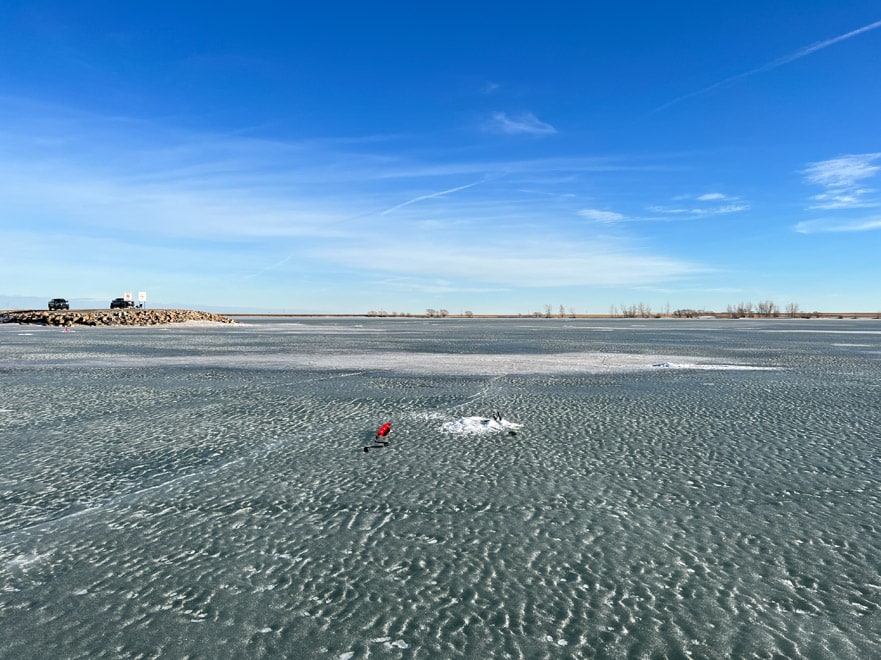
Low reservoir levels can be annoying.
They can also give you an incredible opportunity.
Structure normally hidden underwater becomes visible.
Old roads.
Rock piles.
Channels.
Points.
Drop offs.
Tree remains.
Changes in bottom composition.
Take pictures.
Look at satellite imagery.
Remember where those features are.
When the water rises again, everyone else sees a normal lake.
You know what is underneath it.
That knowledge can be more useful than another box of lures.
Take Photographs When the Water Is Low
This is one of the best reservoir fishing habits.
If you visit a reservoir during unusually low water, document it.
Photograph the shoreline.
Points.
Rocks.
Channels.
Anything interesting.
Save the location.
When the reservoir refills, those features become invisible fish habitat.
You effectively created your own bathymetric reference.
Satellite Images Can Reveal Old Water Levels
Different satellite images may show the same reservoir under different conditions.
A low water image can reveal structure hidden during full supply.
You may see:
Long points.
Old creek channels.
Rocky shorelines.
Submerged roads.
Shallow flats.
Islands that disappear at high water.
That is useful information.
Especially if you fish without expensive electronics.
Reservoir Colour Can Change
Water entering from rivers or canals can carry suspended material.
Wind can stir shallow shorelines.
Algae can affect colour.
A reservoir may therefore look completely different between trips.
Water clarity influences how I fish.
In clear water, I think more about light and presentation.
In stained water, I may use stronger vibration or contrast.
Walleye are particularly comfortable under reduced light conditions, which is one reason southern prairie reservoirs can produce excellent walleye fishing even when the water does not look beautifully clear.
Pretty water is not automatically productive water.
Mud Lines Can Be Worth Fishing
Strong wind hitting a shallow shoreline can stir sediment.
Now you have dirty water beside clearer water.
That boundary can create a feeding edge.
Predators can use reduced visibility to approach prey.
Rather than avoiding every patch of discoloured water, fish the transition.
Especially when the dirty water is not completely opaque.
The edge can be much more interesting than either extreme.
Reservoirs Often Lack Natural Shoreline Complexity
Many natural lakes contain irregular bays, islands, reeds, fallen timber and varied shorelines.
Some prairie reservoirs can look much simpler.
Long open banks.
Rock.
Mud.
Large flats.
That means the limited structure becomes even more important.
One rocky point can attract a lot of attention.
One old channel can organize fish movement.
One patch of weeds can become a major habitat feature.
One steep bank can consistently provide shore access to deep water.
Scarcity makes structure valuable.
Find the Changes
This is how I approach a reservoir that looks featureless.
I look for something different.
Rock beside mud.
Shallow beside deep.
Weeds beside open water.
Current beside still water.
A point interrupting a straight shoreline.
A channel crossing a flat.
An island.
A sharp bank.
A submerged road.
Anything that breaks the pattern.
Fish do not require dramatic structure.
Sometimes a subtle change is enough.
Northern Pike Make Reservoir Weeds Important
Where healthy vegetation develops, pike have an obvious reason to use it.
Shallow vegetation provides ambush cover and attracts prey.
But reservoir weeds can move with changing water levels.
A weed edge that grew perfectly at one depth may become exposed if the reservoir falls.
Another band may develop farther out.
So do not only remember:
The weeds were here.
Remember the depth and bottom where they grew.
Then search for that combination again.
Perch Can Follow Those Vegetation Changes
Yellow perch also use vegetation.
If the weed line moves, perch habitat can move with it.
And where perch move, larger predators can follow.
This is why finding baitfish can be more valuable than finding your favourite old waypoint.
The food web responds to the reservoir.
So should you.
Walleye Make Depth Changes Important
Walleye often use structure connecting shallow feeding areas with deeper water.
Points.
Channel edges.
Breaks.
Rocky slopes.
Those features become particularly useful in reservoirs because the absolute depth above them can change as the water level changes.
A hump might be too deep to interest you under one condition and perfect under another.
Do not think of a walleye spot as a coordinate.
Think of it as structure sitting beneath a changing amount of water.
Crawling Valley Shows How Important Reservoir Fisheries Have Become
Crawling Valley is one of several southern Alberta irrigation reservoirs included in ACA fisheries research.
In ACA’s survey of nine southern reservoirs, walleye, northern pike and lake whitefish were found in every reservoir sampled. Yellow perch were found in most of them.
That is an impressive transformation.
Infrastructure built around water storage and irrigation now supports complete sport fish communities.
These are not secondary fisheries.
For many southern Alberta anglers, reservoirs are the main event.
McGregor Is Another Classic Example
McGregor is exactly the type of reservoir that teaches shore anglers about structure.
Long shorelines can look empty.
Then one rock wall, point or deeper access area produces fish repeatedly.
That does not mean fish love parking beside a particular landmark.
The physical structure is better.
Depth approaches shore.
Rock provides habitat.
Predators can move between feeding and deeper water.
Once you understand why a location produces, you can begin finding similar locations elsewhere.
That is much more useful than collecting fishing pins.
Pine Coulee Can Teach the Same Lesson
Pine Coulee is long and narrow.
Water level becomes extremely noticeable because the reservoir shape makes exposed shoreline obvious when levels change.
A location that looked deep during one visit can feel surprisingly shallow during another.
This is exactly where checking current conditions matters.
Do not assume your memory of the reservoir represents today’s reservoir.
Drought Makes Reservoir Knowledge Even More Important
Southern Alberta naturally experiences periods of limited water supply.
During drought, reservoir storage becomes even more important.
Alberta monitors water shortage conditions because low stream flows and reservoir levels can approach management thresholds.
For anglers, that can translate into dramatic changes in access and habitat.
The correct response is not simply:
The lake is low, so fishing is bad.
Sometimes fishing can still be excellent.
But your old assumptions may no longer work.
Low Water Can Concentrate Fish
There is another side to falling water.
Less water can sometimes make fish easier to locate.
A giant shallow bay becomes unusable.
Fish move toward remaining depth.
Baitfish concentrate.
Predators may become easier to find.
This does not guarantee better fishing.
It means the fish have fewer choices.
If you locate the surviving habitat, you may locate a lot of fish.
High Water Can Spread Fish Out
The reverse can happen when the reservoir fills.
Suddenly there is flooded shoreline everywhere.
New shallow habitat opens.
Fish have more options.
Pike can move into newly flooded areas.
Baitfish can spread.
The spot where you caught ten fish under lower water may feel empty.
The fish population did not necessarily decline overnight.
The available habitat expanded.
This Is Why Fishing Reports Need Context
Someone says:
McGregor was amazing last June.
Okay.
What was the water level?
Wind?
Temperature?
Where were the fish?
What habitat were they using?
Someone else goes to the same coordinates under completely different reservoir conditions and catches nothing.
Both reports can be accurate.
Fishing information becomes useful only when you understand the conditions behind it.
Keep a Reservoir Journal
For reservoirs, I would record more than fish catches.
Write down:
Water level if available.
Whether the reservoir looked high or low.
Wind direction.
Approximate depth.
Water clarity.
Structure.
Vegetation.
Where baitfish appeared.
Then record the fish.
After several trips, you may notice patterns.
Maybe one point works best when water is high.
Another bank becomes better when the level drops.
One bay needs west wind.
One channel edge holds walleye consistently.
That is real reservoir knowledge.
Check Water Data Before Driving
Alberta maintains current water monitoring information through the Alberta River Basins system and reservoir storage summaries.
You do not need to become a hydrologist.
You are simply looking for context.
Is storage unusually low?
Has the reservoir been dropping?
Has recent precipitation changed conditions?
That small amount of research can explain what you see when you arrive.
Do Not Compare Reservoirs Only by Size
A bigger reservoir is not automatically a better fishery.
Shape matters.
Depth matters.
Spawning habitat matters.
Food matters.
Water management matters.
Connectivity matters.
Stocking history matters.
Fishing pressure matters.
A relatively small reservoir can produce excellent fishing if the biological conditions line up.
A huge body of water can be much harder.
Reservoir Fishing Rewards Anglers Who Notice Change
Natural lakes change too.
Wind.
Temperature.
Season.
Vegetation.
Water level.
Nothing in fishing is completely stable.
But managed reservoirs add another major variable.
Water operations.
That makes them challenging.
It also makes them interesting.
You can fish the same southern Alberta reservoir for years and keep discovering new structure because different water levels reveal different versions of it.
My First Question Would Be Different Now
When I started fishing reservoirs, I would ask:
Where did people catch walleye?
Now I would rather know:
What was the reservoir doing when they caught them?
High water?
Low water?
Rising?
Falling?
Were fish shallow?
On channel edges?
Beside rock?
Near vegetation?
Was the wind blowing into the bank?
Those answers can help me find my own fish.
A coordinate usually cannot.
How I Would Approach an Unfamiliar Southern Alberta Reservoir
Before leaving home, I would look at the reservoir shape and available contours.
I would check recent water conditions.
Then I would identify several different pieces of structure rather than one destination.
A point.
A steep shoreline.
An inflow.
A channel edge.
A weed area.
A rocky section.
When I arrive, I would compare the map with the actual water level.
If the reservoir is much lower than expected, I adjust immediately.
I do not spend half the day trying to fish the lake that existed in my head.
If I Were Fishing From Shore
I would prioritize access to depth.
Steeper banks.
Points.
Rock.
Channels approaching shore.
Places where the shoreline changes direction.
I would also pay close attention to wind.
And I would be willing to walk.
The obvious flat shoreline beside the parking lot may be convenient and almost useless under low water.
If I Had a Boat or Kayak
I would search structure aggressively.
Reservoir fish can move when levels change.
I want to identify where the productive depth intersects:
Rock.
Weeds.
Channels.
Points.
Bait.
Then I slow down.
The watercraft is not valuable because it magically catches fish.
It lets me follow habitat as the reservoir changes.
The Reservoir Is Telling You What Changed
Exposed mud means the old shoreline moved.
Dead weeds mean vegetation habitat changed.
A newly flooded bank means new habitat opened.
A visible old road means you just learned what lies beneath high water.
Current at a canal or inflow means water is moving.
A steep exposed bank tells you deeper water may remain nearby.
None of this requires expensive electronics.
It requires paying attention.
Southern Alberta Reservoir Fishing Is Its Own Skill
This is what makes fishing here different from following generic advice written for Minnesota, Ontario or British Columbia.
Southern Alberta has an enormous irrigation network.
More than 55 reservoirs sit within Alberta irrigation districts, connected to thousands of kilometres of water conveyance infrastructure.
Those reservoirs support communities.
Agriculture.
Wildlife.
Recreation.
And some excellent fisheries.
But they are working reservoirs.
Water level is not background information.
It is part of the habitat.
Once you start treating it that way, a lot of confusing fishing trips begin making sense.
The spot did not necessarily stop being good.
The lake changed around it.
Find where the structure, food and usable depth moved.
That is where I would start looking for the fish.

Recent Fishing Reports